Virginia Room Digital Collection

Welcome!

The Virginia Room Digital Collection includes photographs, oral histories, books, pamphlets and finding aids to items in the Virginia Room. Continue to check back for new additions.

Browse Items (6448 total)

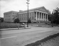
Davis 28.01b Old Lutheran Church.jpg
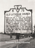
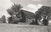
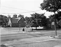
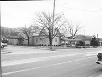
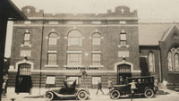
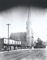
Now the site of Brandon Oaks Lifecare Retirement Home, tradition has it that this structure was the first Lutheran Church in the area. A historical marker is located in the area where the church once stood.

Davis2 28.3 Christ Lutheran.jpg
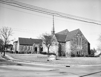
Christ Lutheran Church, located at 2011 Brandon Avenue SW.

Davis2 29c Calvary Baptist.jpg
Calvary Baptist Church, located at 608 Campbell Avenue SW.

Davis2 29d Calvary Baptist.jpg
Calvary Baptist Church, located at 608 Campbell Avenue SW.

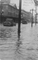
Davis 3.13 1927 Roanoke Flood.jpg
Cars drive through water on Campbell Avenue in front of the Market Building.

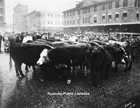
Davis 3.14 Cows on Market.jpg
Cows on market for a livestock auction.

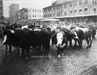
Davis 3.15 Cows on Market.jpg
Cows on market for a livestock auction.

Davis 30.1a Garst Log House.jpg
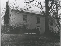
Once located just off of Garst MIll Road at the intersection of Grandin Road Extension, Garst Log Cabin is believed to be one of the earliest homes in the area. It was built around 1800.

Davis 30.1b Fishburn House.jpg
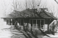
Located at 3542 Peakwood Drive, this home was constructed for Robert Fishburn in 1968. Its unique construction was meant to blend with its natural surroundings.

Davis 30.1c Sun Valley.jpg
Located just off of Williamson Road, this photo depicts the Sun Valley subdivision where Tampa Drive intersects Orlando Avenue.

Davis 30.1d Speedwell.jpg
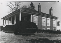
Located at 6135 Merriman Road in Roanoke County, Speedwell was built around 1831 by Lewis Harvey. The house contains elements of Greek Revival style architecture.

Davis 30.1e Monterey.jpg
Located of of Tinker Creek Lane in Northeast, Monterey was built around 1845. The home is an example of Greek Revival architecture most commonly found in the Gulf Coast States.

Davis 30.1f Brown House Store.jpg
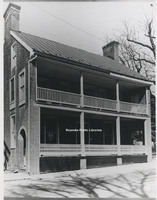
Located at 801 E. Main Street in Salem, Williams-Brown House-Store was built around 1845 by tradesman William Williams. The structure was used as both a home and a store. It is now the home of the Salem Museum and Historical Society.

Davis 30.1g Monterey.jpg
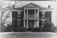
Located at 110 High Street, Monterey was built around 1855 by Benjamin Deyerle. It is one of many houses built by Deyerle in the valley and reflects his Greek Revival architectural style.

Davis 30.1h Belle Air.jpg
Located at 3820 Belle Air Circle, Belle Aire was built around 1849 by Benjamin Deyerle for Madison Pitzer.

Davis 30.1i Pleasant Grove.jpg
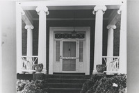
Located at 4377 W. Main Street, Pleasant Grove was built in 1853 for Joseph Deyerle. This photo depicts a close-up of the front door of the Georgian style home.

Davis 30.1j Virginia Farm House.jpg
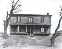
Formerly located at 2801 Brandon Place, this house was typical of Virginia Farm Houses of the 19th Century.

Davis 30.1k Row Houses.jpg
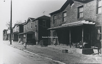
Row Houses like those pictured were an important part of Roanoke's architectural growth. The houses in this photo were once located on Rutherford Avenue Northeast.

Davis 30.1l Evans House.jpg
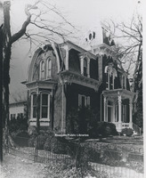
Located at 213 N. Broad Street in Salem, the Evans house was built around 1882 by John M. Evans in the Second Empire style.

Davis 30.1m Gothic Revival Style House.jpg
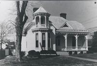
This home was once located at 5415 Plantation Road. A casuality of urban sprawl, this home was an example of Gothic Revival architecture.

Davis 30.1n Queen Anne Style House.jpg
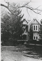
Located at 103 Union Street, this home is reflective of the Queen Anne style. It was built in 1901 by M.G. McClung, an editor of the Salem Sentinel.

Davis 30.1o Queen Anne Style House.jpg
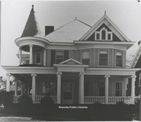
Located at 414 Walnut Avenue, this home was built by J.H. Gibboney, a chemist at Norfolk & Western. One of many examples of the Queen Anne style of Architecture in the Roanoke Valley.

Davis 30.1p Colonial Revival House.jpg
Located at 101 27th Street SE in South Roanoke, this Colonial Revival-Style House was designed by architect Robert Allen.

Davis 30.1r Bungalow Style House.jpg
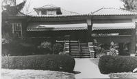
Located at 2607 Rosalind Avenue, this home was built in 1931 and is an example of Bungalow-Style architecture.

Davis 30.1s The Morris House.jpg
Built in 1963 by Jim Yeatts, the Morris House is located at 2831 Wilton Road.

Davis 30.1u Shaffers Crossing Roundhouse.jpg
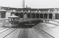
This 115 foot roundhouse was constructed in sections by J.P. Pettyjohn and Company with the first 21 stalls on July 1, 1918. The first stalls and turntable were put into service on September 15, 1919. The turntable was erected by Norfolk and Western…

Davis 31.11a Fort Greenridge.jpg
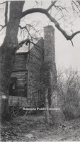
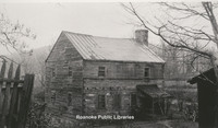
Fort Greenridge was located on the west branch of Carvins Creek near Kingstown. In addition to Fort Greenridge, the structure was also called Garst's Fort and Schwarz's Fort as it was owned by Frederick Garst and Chris Schwarz. Fort Greenridge was…

Davis 31.11b Fort Green Ridge.jpg
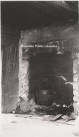
Fireplace located inside Fort Greenridge. Fort Greenridge was located on the west branch of Carvins Creek near Kingstown. In addition to Fort Greenridge, the structure was also called Garst's Fort and Schwarz's Fort as it was owned by Frederick…

Davis 31.11c Fort Greenridge.jpg
Fort Greenridge was located on the west branch of Carvins Creek near Kingstown. In addition to Fort Greenridge, the structure was also called Garst's Fort and Schwarz's Fort as it was owned by Frederick Garst and Chris Schwarz. Fort Greenridge was…

Davis2 31.50 Mountain View.jpg
Mountain View, a 40 room elegant turn-of-the-century mansion, was built in 1907 by Junius B. Fishburn. Mr. Fishburn donated Mountain View to the City in 1955 with the stipulation that it be used solely and exclusively for public recreation purposes. …

Davis2 31.501 Mountain View.jpg
Mountain View, a 40 room elegant turn-of-the-century mansion, was built in 1907 by Junius B. Fishburn. Mr. Fishburn donated Mountain View to the City in 1955 with the stipulation that it be used solely and exclusively for public recreation purposes. …

Davis 33.1 3rd Street Home.jpg
House located near the intersection of Luck Avenue and 3rd Street. The fire escape on the left is that of the old Lewis-Gale Hospital which stood on the corner. Both the house and the hospital have long been gone.

Davis2 33.31 406 Day Avenue.jpg
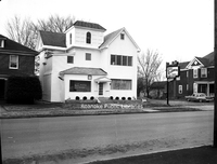
Home located at 406 Day Avenue SW. This was the home of the photographer, George C. Davis.

Davis2 35.12 OSW Apartments.jpg
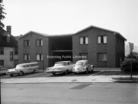
Apartments located at 110 Mountain Avenue SW.

Davis2 35.13 OSW Apartments.jpg
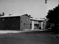
Apartments located at 201 Mountain Avenue SW.

Davis2 35.14a OSW Apartments.jpg
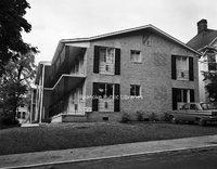
Apartments located at 217 Mountain Avenue SW.

Davis2 35.14b OSW Apartments.jpg
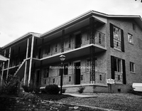
Apartments located at 217 Mountain Avenue SW.

Davis2 35.2 Grandin Apartments.jpg
Apartments located at 1801 Grandin Road SW.

Davis2 35.3 Jefferson Apartments .jpg
The Jefferson Apartments, formerly located at 820 S. Jefferson Street.

Davis2 36.1a Kimball Acres.jpg
Newly constructed homes along the 500 block of Moran Avenue in the Kimball Acres subdivision.

Davis2 36.1b Kimball Acres.jpg
Newly constructed homes along the 500 block of Moran Avenue in the Kimball Acres subdivision.

Davis2 36.1c Kimball Acres.jpg
Newly constructed homes along the 500 block of Moran Avenue in the Kimball Acres subdivision.

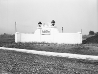
Davis2 36.1d Kimball Acres.jpg
Sign at the entrance of the Kimball Acres subdivision.

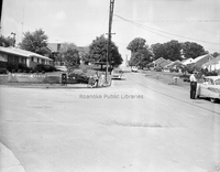
Davis2 36.2a Wilmont Farms.jpg
Looking north on 36th Street NW from Troutland Avenue in the Wilmont Farms neighborhood.

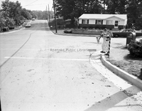
Davis2 36.2b Wilmont Farms.jpg
Looking south on 36th Street NW from Troutland Avenue in the Wilmont Farms neighborhood.

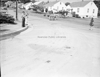
Davis2 36.2c Wilmont Farms.jpg
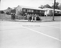
Looking north on 36th Street NW from Troutland Avenue in the Wilmont Farms neighborhood. Safety patrol students from Fairview Elementary School monitor traffic.

Davis2 36.2d Wilmont Farms.jpg
Safety patrol students from Fairview Elementary School on the corner of 36th Street NW and Troutland Avenue in the Wilmont Farms neighborhood.

Davis2 39 1130 2nd Street-1.jpg
Home located at 1130 2nd Street SW.

Davis2 39 1130 2nd Street-2.jpg
Home located at 1130 2nd Street SW.

Davis2 39 1802 Greenwood Road-1.jpg
Home located at 1802 Greenwood Road SW.

Davis2 39 1802 Greenwood Road-2.jpg
Home located at 1802 Greenwood Road SW.

Davis2 39 1847 Maiden Lane.jpg
Home located at 1847 Maiden Lane SW.

Davis2 39 2434 Charing Cross.jpg
Home located at 2434 Charing Cross Drive.

Davis2 39 337 Parkwood Avenue.jpg
Home located at 337 Parkwood Avenue in Salem.

Davis2 39 3547 Kenwick Trail.jpg
Home located at 3547 Kenwick Trail SW.

Davis2 39a  3105 Somerset.jpg
Home located at 3105 Somerset Street.

Davis2 39b 3112 Somerset-1.jpg
Home located at 3112 Somerset Street.

Davis2 39c 3112 Somerset-2.jpg
Rear view of home located a 3112 Somerset Street.

Davis2 39d 3358 Peakwood-1 .jpg
Home located at 3358 Peakwood Drive.

Davis2 39e 3358 Peakwood-2.jpg
Home located at 3358 Peakwood Drive.

Davis2 39f 40 Sawyer Drive.jpg
House located at 40 Sawyer Drive in the West Club Forest subdivision in Salem.

Davis2 43.11 Shenandoah Building.jpg
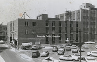
The Shenandoah Building, located at 305 1st Street.

Davis 43.12 Appalachian Power Company.jpg
Rear view of Appalachian Power Company as seen from Bullitt Avenue.

Davis2 43.1263 AEP Truck.jpg
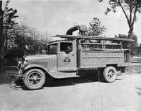
Appalachian Electric Power Company truck.

Davis2 43.1264 AEP Kanawha Plant.jpg
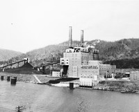
Located near Glasgow, West Virginia, the Kahawha River Plant is a coal-fired power station owned and operated by AEP.

Davis2 43.1265 AEP Truck.jpg
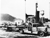
Appalachian Power employees haul an electric pole at an unidentified plant.

Davis2 43.1271 AEP.jpg
Contruction of Appalachian Power office located at 614 1st Street SW. View looking east on Bullitt Avenue.

Davis2 43.127a AEP.jpg
Appalachian Power, located at 40 Franklin Road SW.

Davis2 43.15 General Stone and Materials..jpg
General Stone and Materials Corporation, formerly located at 1401 Franklin Road.

Davis 43.2-1 Norfolk & Western Office Building.jpg
Norfolk & Western Regional Offices, once located at the corner of Jefferson Street and 1st Street.

Davis2 43.214 N&W Offices.jpg
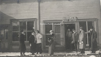
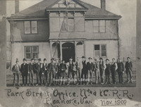
Railroad employees stand in front of the Norfolk & Western Office building formerly located on 5th Street.

Davis 43.411 Roanoke Industrial Loan.jpg
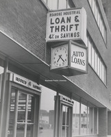
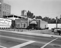
Roanoke Industrial Loan & Thrift, formerly located at 20 Franklin Road.

Davis2 43.51 Williamson Building.jpg
The Williamson Building was located at the corner of Church Avenue and Jefferson Street. The address of Graves-Humphreys Hardware was 311 S. Jefferson Street.

Davis2 43.6 Paul C. Agee Insurance.jpg
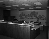
Employees of Paul C. Agee Insurance Company in the office.

Davis2 43.61 Allstate Insurance.jpg
Allstate Insurance, formerly located at 3517 Brandon Avenue.

Davis2 43.611 Allstate Insurance.jpg
Allstate Insurance, formerly located at 3517 Brandon Avenue SW.

Davis2 43.62 Congela Building.jpg
Congela Building, located at 2823 Williamson Road.

Davis2 43.63 Motor Finance Company.jpg
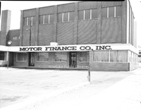
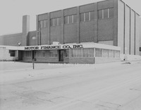
Motor Finance Company, formerly located at 428 Campbell Avenue SW.

Davis2 43.631 Motor Finance.tif
Motor Finance Company, formerly located at 428 Campbell Avenue SW.

Davis2 43.7 C&P Telephone Float.jpg
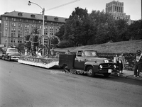
Parade float for C&P Telephone Company.

Davis2 43.713 Shenandoah Life.jpg
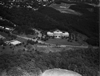
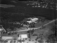
An aerial view of Shenandoah Life Insurance Company, located at 2301 Brambleton Avenue SW.

Davis2 43.714 Shenandoah Life.jpg
An aerial view of Shenandoah Life Insurance, located at 2301 Brambleton Avenue SW.

Davis2 43.8 Peoples Federal.jpg
People's Federal Savings and Loan, formerly located in the Liberty Trust Building at 101 Jefferson Street.

Davis2 43.861 SWVA Savings & Loan.jpg
Southwest Virginia Savings & Loan, formerly located at 306 2nd Street SW. View is looking north.

Davis2 43.862 SWVA Savings & Loan.jpg
Southwest Virginia Savings & Loan, formerly located at 306 2nd Street SW

Davis2 43.86a SWVA Savings & Loan.jpg
Southwest Virginia Savings & Loan, formerly located at 306 2nd Street SW.

Davis2 44.13 Caldwell-Sites Company.jpg
Caldwell-Sites Company Booksellers, formerly located at 105 S. Jefferson Street.

Davis 44.17 Thurman Property.jpg
Thurman & Boone, formerly located at 401 Jefferson Street.

Davis 44.171 Thurman Property.jpg
Looking north at 401- 407 Jefferson Street. Herbert's Fine Feminine Footwear, Woolworth and Thurman & Boone occupied these storefronts.

Davis2 44.328 Joy Shop.jpg
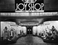
The Joy Shop, formerly located at 27 W. Campbell Avenue. It would later move to the corner of Jefferson Street and Campbell Avenue.

Davis2 44.4 Smartwear Irving-Saks.jpg
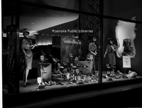
Window display at Smartwear Irving-Saks, formerly located at 210-212 S. Jefferson Street.

Davis2 44.5a Goodwill Industries.jpg
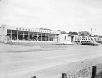
Goodwill Industries workshop, formerly located at 3125 Salem Turnpike.

Davis2 44.5c Goodwill Industries.jpg
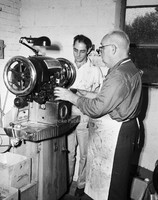
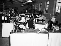
Unidentified employees work in the Goodwill Industries workshop, formerly located at 3125 Salem Turnpike.

Davis2 44.5d Goodwill Industries.jpg
Unidentified employees work in the Goodwill Industries workshop, formerly located at 3125 Salem Turnpike.

Davis2 44.5e Goodwill Industries.jpg
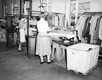
Unidentified employees make repairs to donated clothing at the Goodwill Industries workshop, formerly located at 3125 Salem Turnpike.

Davis2 44.5f Goodwill Industries.jpg
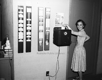
An unidentified employee punches the time clock at Goodwill Industries.

Davis2 44.5g Goodwill Industries.jpg
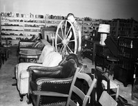
An interior view of Goodwill Industries, formerly located at 3125 Salem Turnpike.

Davis2 44.5h Goodwill Industries.jpg
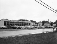
Goodwill Industries workshop and storefront, formerly located at 3125 Salem Turnpike NW.

Davis2 44.6 Leggetts.jpg
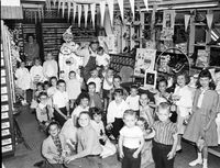
Interior view of the children's department at Leggett's, formerly located 112 Campbell Avenue.

Davis2 44.7 Schulte United.jpg
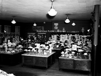
Interior view of Schulte United Millinery, formerly located at 16 Campbell Avenue SW.

Davis2 44.7141 Kroger.jpg
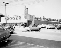
Kroger, formerly located at 1319 Grandin Road SW, now Roanoke Natural Foods Co-op.

Davis2 44.7144 Kroger.jpg
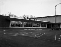
Kroger, formerly located at 1502 Williamson Road NE next to Sears Town.

Davis2 44.8 Barrs Variety Store.jpg
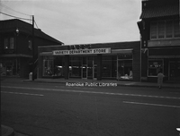
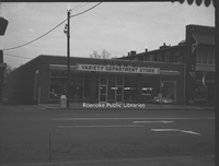
Barr's Variety Store, formerly located at 1318 Grandin Road SW.

Davis2 44.81 Barrs Variety Store.jpg
Barr's Variety Store, formerly located at 1318 Grandin Road SW.

Davis2 44.82a Barrs Variety Store.jpg
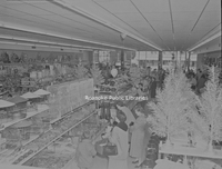
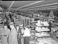
Shoppers inside Barr's Variety Store, formerly located at 1318 Grandin Road SW.

Davis2 44.82c Barrs Variety Store.jpg
Shoppers in Barr's Variety Store, formerly located at 1318 Grandin Road SW.

Davis2 44.82d Barrs Variety Store.jpg
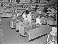
Cash registers at Barr's Variety Store, formerly located at 1318 Grandin Road SW.

Davis2 45.311 Bowman Bakery.jpg
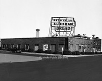
Bowman Bakery, formerly located at 102 5th Street NW.

Davis2 45.64 ITT.jpg
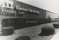
ITT Exelis, located at 7635 Plantation Road.

Davis2 45.641 ITT.jpg
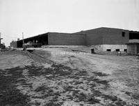
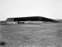
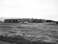
Construction of ITT Exelis, located at 7635 Plantation Road.

Davis2 45.642 ITT.jpg
Construction of ITT Exelis, located at 7635 Plantation Road.

Davis2 45.643 ITT.jpg
Construction of ITT Exelis, located at 7635 Plantation Road.

Davis2 45.9 Roanoke Gas.jpg
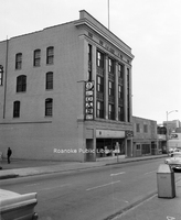
Main office of Roanoke Gas Company, formerly located at 123-125 Church Avenue SW.

Davis2 45.91 Roanoke Gas.jpg
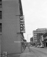
Looking east on Church Avenue in front of Roanoke Gas Company, formerly located at 123-125 Church Avenue SW. The sign was illuminated by gas burners.

Davis2 45.92 Roanoke Gas.jpg
Looking east on Church Avenue in front of Roanoke Gas, formerly located at 123-125 Church Avenue SW. The sign was illuminated by gas burners. Sign panels have been removed as the gas burners are being replaced with electric lights.

Davis2 46.222 Jarrett-Chewning.jpg
Jarrett-Chewning Company, formerly located at 1854 S. Jefferson Street.

Davis2 46.223 Jarrett-Chewning.jpg
Jarrett-Chewning Company, formerly located at 1854 S. Jefferson Street.

Davis2 46.224 Jarrett-Chewning.tif
Unidentified employees stand in front of Jarrett-Chewning Company, formerly located at 1854 S. Jefferson Street.

Davis2 46.225 Jarrett-Chewning.jpg
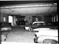
Garage interior of Jarrett-Chewning Company, formerly located at 1854 S. Jefferson Street.

Davis2 46.226 Jarrett-Chewning.jpg
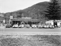
Jarrett-Chewning Company, formerly located at 1854 S. Jefferson Street.

Davis2 46.227 Jarrett-Chewning.jpg
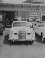
A Mercedes on the sales lot of Jarrett-Chewning Company, formerly located at 1854 S. Jefferson Street.

Davis2 46.228 Jarrett-Chewning.jpg
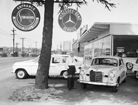
An unidentified employee stands next to a Mercedes on the sales lot of Jarrett-Chewning Company, formerly located at 1854 S. Jefferson Street.

Davis2 46.333 Fort Lewis Esso.jpg
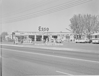
Fort Lewis Esso Servicenter, formerly located at 1905 W. Main Street in Salem.

Davis2 46.334 Williamson Esso.jpg
Williamson Road Esso, formerly located at 2715 Williamson Road NE.

Davis2 46.34a Gulf Station.jpg
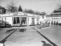
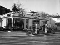
Wasena Gulf Service, formerly located at 1119 Main Street.

Davis2 46.34b Gulf Station.jpg
Wasena Gulf Service, formerly located at 1119 Main Street.

Davis2 46.5 Moore Tire.jpg
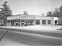
Moore Tire Company, formerly located at 1860 S. Jefferson Street.

Davis2 46.516 BF Goodrich.jpg
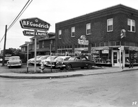
B.F. Goodrich Home and Auto, formerly located at 3520 Williamson Road NW.

Davis2 46.6 Magic City Ford.jpg
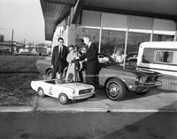
Magic City Ford promotion.

Davis2 46.61 Magic City Ford.jpg
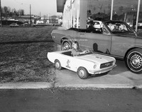
Unidentified girl sits in toy Mustang at Magic City Ford.

Davis2 46.62 Magic City Ford.jpg
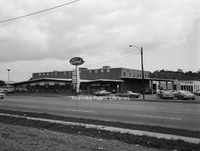
Magic City Ford, located at 809 Williamson Road NE.

Davis2 46.7 Dickerson GMC.jpg
Dickerson GMC, formerly located 715 Patterson Avenue SW.

Davis2 46.8 Butterfields Golf Carts.jpg
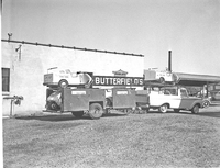
Butterfield's Golf Carts.

Davis2 46.81 Chewning Garage.jpg
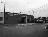
Chewning Garage and Body Shop, formerly located at 3034 Wentworth Avenue NW.

Davis2 43.863 SWVA Savings & Loan.jpg
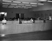
Employees inside Southwest Virginia Savings & Loan, formerly located at 306 2nd Street SW.

Davis2 46.9 Rutrough Motors.jpg
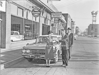
An unidentified customer and employees in front of Rutrough Motors, formerly located at 335 Luck Avenue SW.

Davis2 46.91 Rutrough Motors.jpg
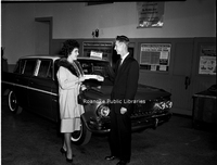
An unidentified customer and employee in the showroom of Rutrough Motors, formerly located at 335 Luck Avenue SW.

Davis2 47.12b McKesson & Robbins.jpg
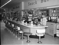
Snack bar inside McKesson & Robbins in Rocky Mount.

Davis2 47.12c McKesson & Robbins.jpg
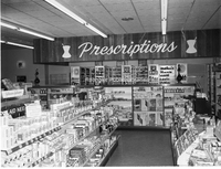
Interior view of McKesson & Robbins Pharmacy in Rocky Mount.

Davis2 47.12d McKesson & Robbins.jpg
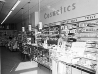
Cosmetics counter in McKesson & Robbins in Rocky Mount.

Davis2 47.14 Warren Gilbert Photography.jpg
Warren Gilbert Photography, formerly located at 4311 Appleton Avenue NW.

Davis2 47.2 Roanoke Sash.jpg
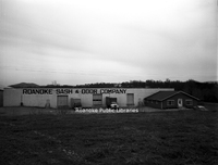
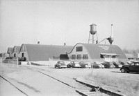
Roanoke Sash & Door Company, formerly located at 999 13th Street SW.

Davis2 47.3 Oren Roanoke.jpg
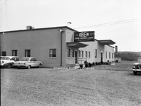
Oren Roanoke Corporation, formerly located at 720 3rd Street in Vinton.

Davis2 47.5 Thaden-Jordan Furniture.jpg
Thaden-Jordan Furniture Company, formerly located at 312 Kessler Mill Road.

Davis2 47.51  Johnson-Carper.jpg
Architectural rendering of Johnson-Carper Furniture Company, formerly located at 3322 Hollins Road NE.

Davis2 47.52 Winston Property.jpg
Winston Property Management, formerly located at 930 S. Jefferson Street.

Davis2 47.6 Virginia Brewing.jpg
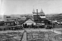
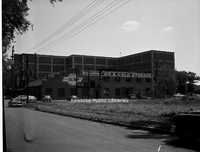
Virginia Brewing Company, formerly located in the 1200 block of Wise Avenue SE.

Davis2 47.61 Virginia Brewing.jpg
Rear view of Virginia Brewing Company, formerly located in the 1200 block of Wise Avenue SE.

Davis2 47.62 Virginia Brewing.jpg
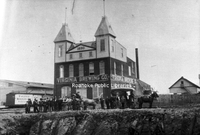
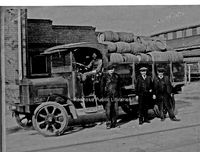
Virginia Brewing Company employees with delivery truck outside of the brewery.

Davis2 47.7 Vinton Weaving.jpg
Vinton Weaving Company, now Precision Fabrics Group, is located at 323 West Virginia Avenue.

Davis2 47.75 Webster Brick.jpg
Employees next to trucks at Webster Brick.

Davis2 47.751 Webster Brick.jpg
Webster Brick (now General Shale), located at 2351 Webster Road.

Davis2 47.76 Roanoke Electric Steel.jpg
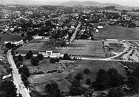
An aerial view of Roanoke Electric Steel, formerly located at 20 30th Street NW.

Davis2 47.8a National Cash Register.jpg
National Cash Register, formerly located at 902 S. Jefferson Street,

Davis2 47.8b National Cash Register.jpg
National Cash Register, formerly located at 902 S. Jefferson Street.

Davis2 47.8c National Cash Register.jpg
Work stations inside National Cash Register, formerly located at 902 S. Jefferson Street.

Davis2 47.9a Dillard Paper.jpg
Dillard Paper Company, formerly located at 2490 Patterson Avenue SW.

Davis2 47.9b Dillard Paper.jpg
Dillard Paper Company, formerly located at 2490 Patterson Avenue SW.

Davis2 48.14 Garst Brothers Dairy.jpg
Garst Brothers Dairy, formerly located at 1118 Salem Avenue SW.

Davis2 48.2 Roanoke Distributing Company.jpg
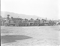
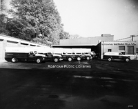
Pabst Blue Ribbon delivery trucks parked at Roanoke Distributing Company, formerly located at 907 3rd Street SE.

Davis2 48.3 Roanoke Grocers.jpg
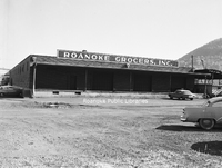
Roanoke Grocers Inc., formerly located at 1131 4th Street SE.

Davis2 48.33 Associated Grocers.jpg
Associated Grocers, formerly located at 359 Kessler Mill Road.

Davis2 48.34 Toms Potato Chips.jpg
Tom's Potato Chips and Farm Credit Association, formerly located on the corner of Sycamore Avenue and Williamson Road NE.

Davis2 48.38 Tom Huston Peanut.jpg
Tom Huston Peanut Company, formerly located at 1340 W. Main Street in Salem.

Davis2 48.39 Warehouse Row.jpg
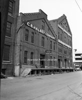
Warehouses along the 100 block of Norfolk Avenue SW, including C.B. Halsey Company and Old Domion.

Davis2 48.4 Hampshire Corp.jpg
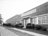
Hampshire Corp., formerly located at 2101 Winston Avenue SW.

Davis2 48.5 Sealtest Foods.jpg
Sealtest Foods, formerly located at 133 Albemarle Avenue SE.

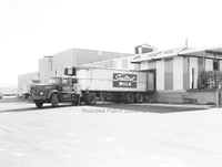
Davis2 48.51 Sealtest Foods.jpg
Employee with tractor-trailer at loading dock of Sealtest Foods, formerly located at 133 Albemarle Avenue SE.

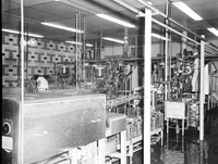
Davis2 48.52 Sealtest Foods.jpg
Production equipment in Sealtest Foods, formerly located at 133 Albemarle Avenue SE.

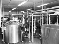
Davis2 48.53 Sealtest Foods.jpg
Production equipment in Sealtest Foods, formerly located at 133 Albemarle Avenue SE.

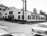
Davis2 48.54 Frigid Freeze.jpg
Frigid Freeze Frozen Foods, formerly located at 103 8th Street SE.

Davis2 48.621 Garland's Drugstore.jpg
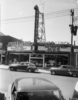
Garland's Drugstore, formerly located at 1327 Grandin Road SW.

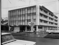
Davis2 48.6234 Garlands Medical Center.jpg
Garland's Medical Center, formerly located at 127 McClanahan Street SW.

Davis2 48.6235 Garlands Drugstore.jpg
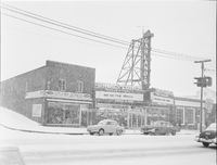
Garland's Drugstore on a snowy day, formerly located at 1327 Grandin Road SW.

Davis2 48.6236a Garlands Drugstore.jpg
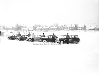
Garland's Delivery Service drivers next to their vehicles on a snowy day.

Davis2 48.63 O'Briens Van.jpg
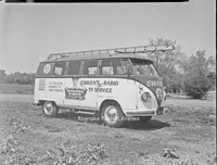
O'Brien's Radio & TV Service van.

Davis2 48.67 Sears Delivery Trucks.jpg
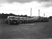
Drivers stand next to Sear's delivery trucks.

Davis2 48.7 Archway Cookies.jpg
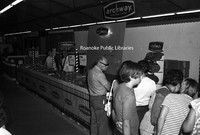
An Archway Cookies booth at an unidentified event.

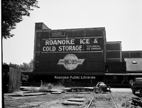
Davis2 48.75 Roanoke Ice.jpg
Roanoke Ice and Cold Storage, formerly located at 806 Wasena Avenue.

Davis2 48.751 Roanoke Ice.jpg
Roanoke Ice and Cold Storage, formerly located at 806 Wasena Avenue.

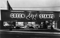
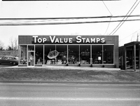
Davis2 48.771 Top value Stamps.jpg
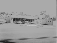
Top Value Stamps, formerly located at 2613 Franklin Road SW.

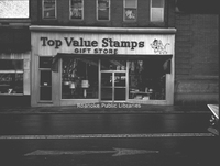
Davis2 48.772 Top Value Stamps.jpg
Top Value Stamps, formerly located at 318 2nd Street SW.

Davis2 48.773 Top Value Stamps.jpg
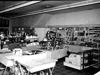
Merchandise inside Top Value Stamps, formerly located at 318 2nd Street SW.

Davis2 48.774 Top Value Stamps.jpg
Top Value Stamps, formerly located at 1519 Williamson Road NE.

Davis2 48.8 Mayfair Caterers.jpg
Mayfair Caterers and Restaurant, formerly located at 1602 Orange Avenue NW. Melrose Seventh Day Adventist Church visible in background.

Davis2 48.81 Patty Wagon.jpg
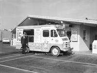
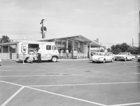
Patty Wagon Hamburgers truck.

Davis2 48.82 Patty Wagon.jpg
Kenney's Patty Wagon Hamburgers, formerly located at 5320 Williamson Road NW.

Davis2 48.83 Biff Burger Sign.jpg
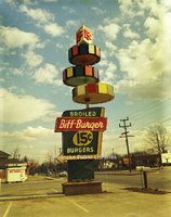
Sign for Biff Burger, formerly located at 4317 Williamson Road NE.

Davis2 48.84 Biff Burger.jpg
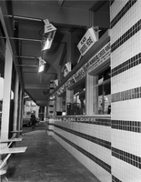
Order windows at Biff Burger, formerly located at 3323 Melrose Avenue NW.

Davis2 48.9 Roma Restaurant.jpg
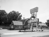
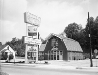
Roma Restaurant (later Villa Sorrento), formerly located at 1210 Patterson Avenue SW.

Davis2 48.94a Lendys Take Home.jpg
Lendy's Take Home Shoppe, formerly located at 4102 Melrose Avenue NW.

Davis2 48.94b Lendys Take Home.jpg
Lendy's Take Home Shoppe, formerly located at 4102 Melrose Avenue SW.

Davis2 48.95 Mullens Place.jpg
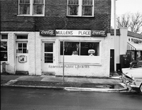
Mullen's Place, formerly located at 307 9th Street SE.

Davis2 49.122 Crossroads Mall.jpg
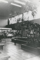
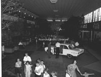
An interior view of Crossroads Mall.

Davis2 49.123 Crossroads Mall.jpg
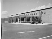
JC Penney at Crossroads Mall, formerly located at 5002 Airport Road NW.

Davis2 49.124a Crossroads Mall.jpg
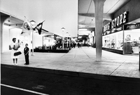
Interior of Crossroads Mall. Crossroads was built in 1961 and was the first enclosed shopping center in Virginia.

Davis2 49.124b Crossroads Mall.jpg
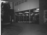
Interior entrance of JC Penney at Crossroads Mall.

Davis2 49.124c Crossroads Mall.jpg
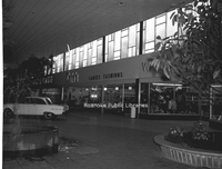
Interior view of Crossroads Mall.

Davis2 49.124d Crossroads Mall.jpg
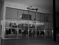
Interior entrance to Sidney's at Crossroads Mall.

Davis2 49.124e Crossroads Mall.jpg
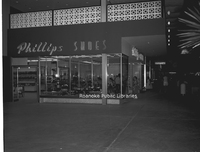
Phillips Shoes in Crossroads Mall.

Davis2 49.124h Crossroads Mall.jpg
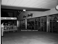
Interior entrance to Roses at Crossroads Mall.

Davis2 49.125 WoolCo.jpg
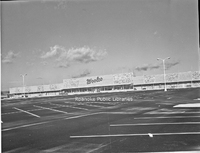
WoolCo Department Store, formerly located at Crossroads Mall, 5002 Airport Road NW. Original anchor stores at Crossroads were J,C. Penney, Roses, Heironimus, Winn-Dixie, People's Drug, Other mall tenants included Fink's Jewelers, Smartwear Irving…

Davis2 49.2 Roanoke-Salem Plaza.jpg
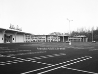
Roanoke-Salem Plaza storefronts, including People's Drug, Miller & Rhoads and Winn-Dixie, formerly located at 4600 Melrose Avenue NW.

Davis2 49.21 Lerner Shops.jpg
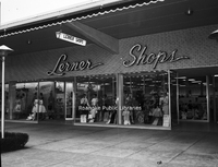
Lerner Shops at Roanoke-Salem Plaza, formerly located at 4142 Melrose Avenue NW.

Davis2 49.22 Roanoke-Salem Plaza.jpg
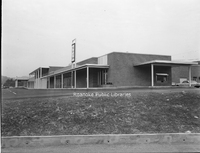
Roanoke-Salem Plaza, formerly located at 4600 Melrose Avenue.

Davis2 49.3 Townside Plaza.jpg
Townside Plaza (now Townside Festival), located at 3600 Franklin Road SW.

Davis2 49.31 Townside Plaza.jpg
Townside Plaza (now Townside Festival), located at 3600 Franklin Road SW.

Davis2 49.4 Sears.jpg
Construction nears completion on Sears Town, formerly located at 1502 Williamson Road NE.

Davis2 49.41 Sears.jpg
Sears Town, formerly located at 1502 Williamson Road NE.

Davis2 49.412 Sears.jpg
Sears Town, formerly located at 1502 Williamson Road NE.

Davis2 56 Waverly Church Choir.jpg
Unidentified members of the Waverly Place Baptist Church Choir.

Davis2 57.5a Viking Lanes.jpg
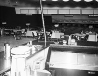
Interior view of Viking Lanes Bowling Alley, formerly located at 2727 Franklin Road.

Davis2 57.5b Viking Lanes.jpg
Interior view of Viking Lanes Bowling Alley, formerly located at 2727 Franklin Road.

Davis2 57.5c Viking Lanes.jpg
Interior view of Viking Lanes Bowling Alley, formerly located at 2727 Franklin Road.

Davis 6.122 Terry House.jpg
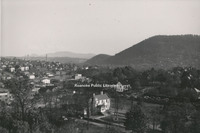
View of the Terry House and Elmwood Park from the Patrick Henry Hotel.

Davis 6.123 Elmwood Corner.jpg
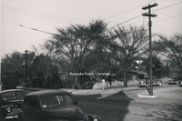
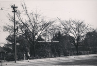
Intersection of Jefferson Street and Elm Avenue, looking toward the SW corner of Elmwood Park. Terry House visible through the trees.

Davis 6.124 Elmwood Corner.jpg
Corner of Jefferson Street and Bullitt Avenue, looking toward the SE corner of Elmwood Park.

Davis 6.125 Elmwood Gazebo.jpg
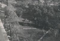
View of gazebo in Elmwood Park from the Patrick Henry Hotel.

Davis2 61.25 Virginian #104.jpg
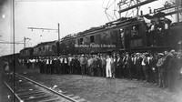
An unidentified group stands in front of Virginian #104, a class EL-#3A electric locomotive.

Davis 61.81 Mill Mountain Incline.jpg
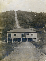
Mill Mountain Incline during construction.

Davis 61.812 Mill Mountain Incline Tracks.jpg
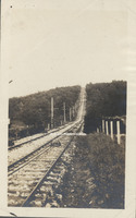
Tracks of the Mill Mountain Incline.

Davis2 62.1342 Airmail Service.jpg
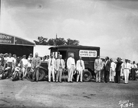
Local officials celebrate the inauguration of airmail service to Roanoke.

Davis2 62.152 Roanoke Regional Airport.jpg
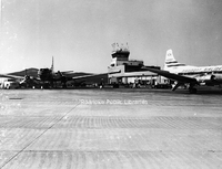
A view of the terminal at Woodrum Field, now Roanoke-Blacksburg Regional Airport.

Davis2 63.1 Safety Motor Transit.jpg
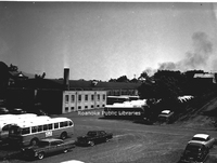
Safety Motor Transit, formerly located at 12th Street and Campbell Avenue SE.

Davis2 63.12 Safety Motor Transit.jpg
Safety Motor Transit, formerly located at 12th Street and Campbell Avenue SE.

Davis2 63.2 Pitzer Transfer.jpg
Pitzer Transfer and Storage, formerly located at 841 Reserve Avenue SW.

Davis2 66.827 Franklin Road Bridge.jpg
Construction of the bridge on South Colorado Street over the railroad tracks in Salem.

Davis2 66.92 Cornelius Charlton Bridge  .jpg
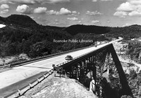
Also known as the Bluestone River Bridge, the Sergeant Cornelius H. Charlton Bridge crosses the Bluestone River in Mercer County, West Virginia. Charlton received the Metal of Honor for his heroic acts in the Korean War.

Davis 68.81 New River Gap.jpg
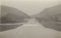
The New River cut a gap between Peters Mountain and East River Mountain at Narrows.

Davis2 7.22 Downtown Salem.jpg
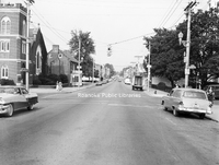
A view of E. Main Street from the Market Street intersection in Downtown Salem.

Davis2 16.7413 Archies House of Beef.jpg
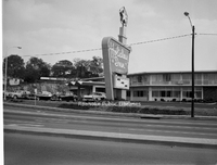
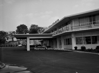
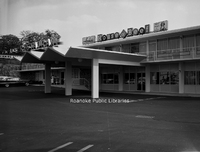
Archie's House of Beef was located in the Holiday Inn that once stood at the corner of Orange Avenue and Williamson Road.

Davis2 75.82 JM Oakey Hearse.jpg
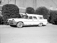
John M. Oakey Funeral Home hearse.

Davis2 75.83 JM Oakey.jpg
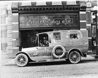
Hearse in front of John M. Oakey Funeral Home, formerly located at 126 Campbell Avenue SW.

Davis2 75.864 Rader Chapel.jpg
Rader Chapel located at 630 Roanoke Road in Daleville. This building was replaced with the current structure in 1996.

Davis 75.91 Daniel Boones Tomb.jpg
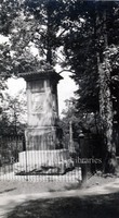
Tomb of Daniel Boone.

Davis 8.1 Main Street Baptist Church.jpg
Main Street Baptist Church in Clifton Forge.

Davis 8.21 Pearisburg.jpg
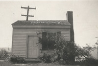
Former medical office of Dr. Harvey Green Johnston. Local tradition holds that it was Rutherford B. Hayes' headquarters while Federal troops accupied Pearisburg during the Civil War. The building is part of Giles County HIstorical Society's museum…

Davis 8.22 Town House in Chilhowie.jpg
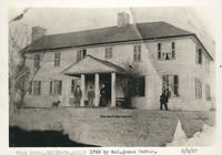
Town House in Chilhowie built in 1748 by Col. James Patton to be used as a fort.

Davis2 8.31 Fincastle Presbyterian.jpg
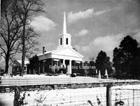
Fincastle Presbyterian Church, located at 108 E. Back Street in Fincastle.

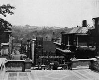
Davis2 8.4 Lynchburg.jpg
A view of Downtown Lynchburg from Courthouse hill.

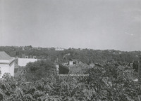
Davis2 8.41 Lynchburg.jpg
A view of Downtown Lynchburg from Courthouse hill.

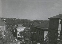
Davis2 8.42 Lynchburg.jpg
A view of Downtown Lynchburg from Courthouse hill.

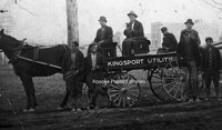
Davis2 8.43 Kingsport Utilities.jpg
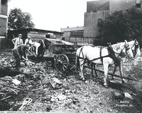
Unidentified men with a Kingsport Utilities wagon.

Davis2 8.5 Botetourt Court Courthouse.jpg
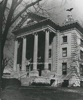
Botetourt County Courthouse, located at 1 W. Main Street in Fincastle.

Davis 8.51 Botetourt County Courthouse.jpg
Botetourt County Courthouse

Davis 91.1d UDC Memorial.jpg
Erected by the South Carolina Division of the United Daughters of the Confederacy as a memorial to Elliott's South Carolina troops who lost their lives in the explosion at The Crater.

Davis 91.1e Fort Mahone Monument.jpg
This monument was erected on the spot where Fort Mahone, known as Fort Damnation by the Union, once stood. It was erected by the State of Pennsylvania in honor of the soldiers who served in the Third Division, 9th Corps, Army of the Potomac.

Davis 91.1f Entrance to Tunnel.jpg
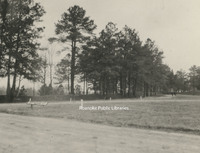
The marker in the right foreground indicates the entrance to the Union tunnel located at the crater.

Davis 91.1g Woodpile at Pine Gardens.jpg
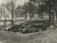
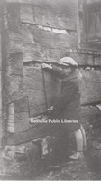
This pile of lumber was the lining placed in the Confederate tunnels at Pine Garden

Davis 91.1h Confederate Breastworks.jpg
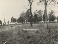
Confederate breastworks near Pine Gardens.

Davis 91.1i The Crater.jpg
The Crater as seen from Union lines.

Davis 91.1j Confederate Tunnels.jpg
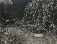
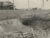
The discovery of the Confederate Tunnels came as a result of a boy chasing a rabbit into this hole. The tunnels were finally discovered after 60 years.

Davis2 91.2 Memorial Tunnel.jpg
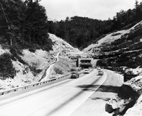
The Memorial Tunnel opened in 1954 to carry traffic through the Paint Creek Mountain on the West Virginia Turnpike. Closed to traffic in 1987, the tunnel is now used for military training.

Davis 31.11d Fort Greenridge.jpg
An unidentified boy measures the logs of Fort Greenridge. Fort Greenridge was located on the west branch of Carvins Creek near Kingstown. In addition to Fort Greenridge, the structure was also called Garst's Fort and Schwarz's Fort as it was owned…

GB057 Decons and Trustees of First Baptist Church Gainsboro.jpg
First Baptist Church Gainsboro can trace its origins back to September 30, 1867, when a small congregation held service, led by Rev. Edmond Johnson, in a dwelling on Hart Avenue, establishing the Big Lick Colored Baptist Church. As membership…

Pinkard1.pdf
A biographical sketch of Dr. Pinkard and his contributions to the field of medicine as well as his contributions to the African American community in Roanoke.

raneyindex.pdf
This index includes surnames found in the E. Marvin Raney Collection. The majority of Raney's research focuses on the families of Bedford and Franklin Counties, though surnames from other counties are represented. Raney worked extensively with Mae…

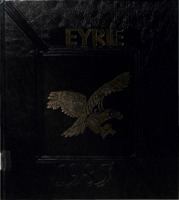
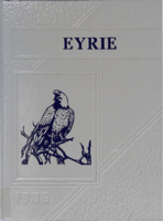
Eyrie1975.pdf
The Eyrie is the annual for Hidden Valley Middle School.

Eyrie1977.pdf
The Eyrie is the annual for Hidden Valley Middle School.

Eyrie1980.pdf
The Eyrie is the annual for Hidden Valley Middle School.

Eyrie1985.pdf
The Eyrie is the annual for Hidden Valley Middle School.

Eyrie1986.pdf
The Eyrie is the annual for Hidden Valley Middle School.

Eyrie 1988.pdf
The Eyrie is the annual for Hidden Valley Middle School.

Franklin Papers.pdf
Family tracings of the Callaway, Tilly, Early, Anderson, Franklin and Cook Families of the counties of Amherst, Appomattox, Bedford and Campbell.

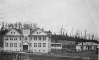
FC001.jpg
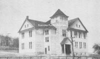
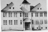
Willis High School in Floyd County, VA. The school closed after the 1961-62 school year.

FC002.jpg
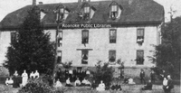
Mountain Normal School dormitory at Willis in Floyd County, VA.

FC003.jpg
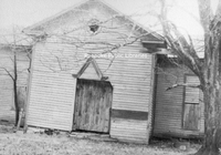
The long abandoned old Mountain Normal School at Willis in Floyd County, VA. The Normal School opened in 1893.

FC004.jpg
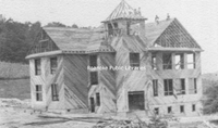
Willis High School under construction.

FC005.jpg
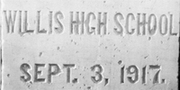
The cornerstone of Willis High School.

FC007.jpg
Willis High School shortly after opening.

FC008.jpg
Willis High School after the addition was completed.

FC011.jpg
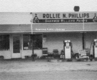
Rollie N. Phillips store and gas station, located in the Indian Valley area of Floyd County. Phillips opened his service station in 1927.

FC012.jpg
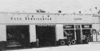
Floyd Esso Service Center in Floyd County.

FC013.jpg
Mountain Normal School students posing in front of the dormitory building.

FC014.jpg
Willis High School. The agricultural building is at right.

FE002 GW Sisler.jpg
G.W. Sisler Funeral Home, formerly located at 23 First (Salem) Avenue.

FE001 First Auto.jpg
Roanoke's first automobile parked in front of a bicycle shop at 109-111 Church Avenue SW. The first auto was believed to have been owned by T.T. Fishburn. In two years, in 1906, this building would become Roanoke Automobile Company selling Rambler…

FE003 Grand Piano.jpg
Grand Piano Furniture was located at 312 2nd Street SW.

FE005 Carolina Cotton Mills.jpg
Carolina Cotton and Woolen Mills, formerly located at 505 6th Street SW.

FE006 JE Bernards.jpg
J.E. Bernard's Machine Shop, formerly located at 109-111 Church Avenue SW. Roanoke Automobile Company is located next door, specializing in the sale of Ramblers.

FE007 Armistice Day Parade.jpg
A contingent of veterans march in the Armistice Day Parade on Campbell Avenue.

FE009 Union Lunch.jpg
Union Lunch, formerly located in the area where the Market Building is today.

FE010 Campbell Avenue.jpg
Looking east on Campbell Avenue toward the Market Building from the roof of the Colonial American National Bank building.

FE011 McGuire Building.jpg
The McGuire Building, located at 1 Market Square, was built in 1914 and housed W. E. McGuire’s Farmers’ Supply Co. that sold buggies, wagons, fertilizer, seed, and other farm-related equipment and supplies.

FE012 Alleghany Institute Students.jpg
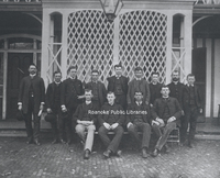
Group portrait of Alleghany Institute students. Individuals unidentifed.

FE013 McGuire Building.jpg
The McGuire Building, located at 1 Market Square, was built in 1914 and housed W. E. McGuire’s Farmers’ Supply Co. that sold buggies, wagons, fertilizer, seed, and other farm-related equipment and supplies. Tenants in this photo include A&P…

FE014 Campbell Avenue.jpg
Looking west on Campbell Avenue. The Rialto Theatre is visible at left.

FE015 Municipal Building.jpg
The Municipal Building from 2nd Street.

FE017 Mountain Trust.jpg
Mountain Trust Bank was located in the Strickland Building at 302 S. Jefferson Street.

FE019 Lakeside.jpg
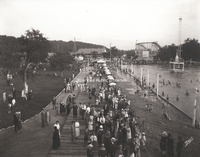
Lakeside Amusement Park was built in 1920 on Mason's Creek. The "lake" seen here was the area's first public swimming pool, complete with sand beach. Also visible is the "Thriller" rollercoaster and the bumper car pavilion.

FE022 Church and Jefferson.jpg
Intersection showing the Williamson Building on the northwest corner of Church Avenue and Jefferson Street. At the time of this photo, the building housed T.L. Deyerle Company. It would later be home to the Sportsman. The building was razed in…

FE023 Big Lick Hotel.jpg
Formerly located on the southwest corner of Williamson Road and Salem Avenue, the Big Lick Hotel would go through several iterations, including a portion of the Shenandoah Hotel, the Lee Hotel and Hotel Earle. The building was gutted by fire in 1991…

FE024 Jefferson Street.jpg
Looking south on Jefferson Street. American Theatre on right.

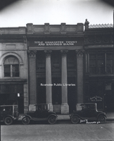
FE027 Title Guarantee.jpg
Title Guarantee Trust and Savings Bank, formerly located at 34 Church Avenue SW.

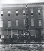
FE028 Fire Ladder.jpg
Firemen pose on a ladder pulled by horses. The building in the background was on the corner of 1st Street and Church Avenue.

FE032 Post Office.jpg
Roanoke's second federally funded post office was constructed on the same site as the first, the corner of Church Avenue and 1st Street. It was built in 1914 and replaced in 1933.

FE033 Big Lick Livery.jpg
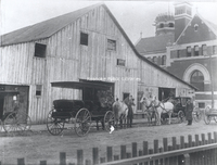
In 1898, the Big Lick Livery Stable stood on Henry Street (1st Street SW) just north of Roanoke's first federally funded post office (located on the NE corner of Henry (1st) Street and Church Avenue) which can be seen in the background. In 1890 this…

FE034 Horton Livery.jpg
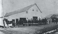
Horton and Roberts Livery Stable stood on Henry Street (now 1st Street SW) just north of the northeast corner of Henry Street and Church Avenue.

FE036 Hotel Roanoke.jpg
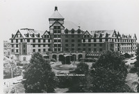
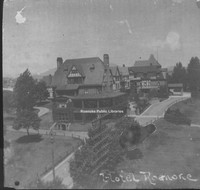
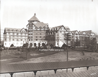
Hotel Roanoke

FE037 Jefferson Street.jpg
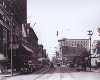
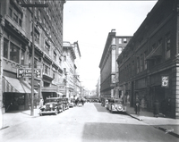
Looking north on Jefferson Street.

FE038 Mill Mountain Incline.jpg
Mill Mountain Incline.

FE041 Almshouse.jpg
The Almshouse or "poor house" was built in 1925. The building is now part of Virginia Western Community College.

FE044 Civil War Veterans.jpg
Civil War veterans reunion at Hotel Roanoke.

FE045 Elmwood Pond.jpg
The pond once in Elmwood Park.

FE046 Patrick Henry Lobby.jpg
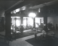
Interior view of the Patrick Henry Hotel lobby.

FE047 Market Building.jpg
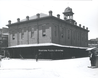
Roanoke's first Market Building. Built in 1886, it was replaced by the current Market Building in 1922.

FE048 FNEB.jpg
The First National Exchange Bank building is located at 201 S. Jefferson Street.

FE049 1st Street.jpg
Looking north on 1st Street from Church Avenue.

FE050 Patrick Henry Hotel.jpg
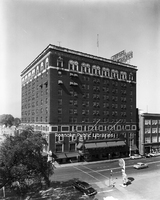
Patrick Henry Hotel

FE052 Mill Mountain.jpg
A view of Mill Mountain. Roanoke Hospital, the Mill Mountain Incline, and the observation tower are all visible.

FE054 Dog Mouth Fountain.jpg
Th Dog Mouth Fountain stands on the northwest corner of Salem Avenue and Market Street. Legend has it that those who drink from the fountain will always return to Roanoke.

FE055 Lewis-Gale.jpg
Lewis-Gale Hospital was built in 1909 as a partnership between Dr. Sparrell Gale and Dr. J.N. Lewis. The original hospital stood at the northwest corner of 3rd Street and Luck Avenue.

FE056 Downtown Roanoke.jpg
Looking north on Jefferson Street from the Colonial National Bank building.

FE057 1st Street.jpg
Looking north on 1st Street from Church Avenue.

FE058 Campbell Avenue.jpg
Crowds gather along Campbell Avenue to watch the Armistice Day Parade.

FE061 UCT Carnival.jpg
Spectators watch the highwire act, part of the Order of United Commercial Travelers of American carnival.

FE062 Natural Bridge Hotel.jpg
The original Natural Bridge Hotel. The hotel burned in 1963 and was replaced by the current hotel in 1964.

FE064 View from Mill Mountain.jpg
A view of Roanoke from Mill Mountain with the Riverland neighborhood in the foreground.

FE065 WDBJ.jpg
WDBJ station at its third location on the corner of Colonial Avenue and Brandon Avenue.

FE066 Observation Tower.jpg
The second observation tower once atop Mill Mountain. The first observation tower was destroyed in a wind storm in 1914. This tower replaced it until 1936, when it was destroyed by fire. George Davis at left.

FE068 Greene Memorial.jpg
Greene Memorial United Methodist Church at the corner of Church Avenue and 2nd Street. In this photograph, a crowd is gathered to watch as the new La France Fire Engine was hauled to the corner to see if it could throw water as high as the steeple…

FE069 Ponce de Leon Hotel.jpg
The original Ponce de Leon Hotel located at 131 Campbell Avenue SW. The elegant verandas are gone by the time this photograph was taken. In December 1930, the building was totally destroyed by fire, killing one resident and injuring others. It was…

FE071 Ponce de Leon Hotel.jpg
The second Ponce de Leon Hotel located at 131 Campbell Avenue SW.

FE072 Jefferson Hospital.jpg
Jefferson Hospital, founded in 1907 by Dr. Hugh Trout, was the predecessor of Carilion Roanoke Community Hospital. Formerly located at 1313 Franklin Road SW, the hospital closed in 1967 and was later razed. The two-story porches no longer exist…

FE075 Alleghany Institute Students.jpg
Group portrait of students and faculty of the Alleghany Institute. Front row, left ot right: Ott Coleman, Jack Airheart, William ?; back row, left to right: B.S. Brooke, Eugene Turner, Ernest B. Fishburn, Billy Malone, D. Thomas Taylor, Romeo…

FE079 RHS Gymnasts.jpg
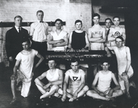
Roanoke High School gymnasts. Caption reads, "Winners Intermediate Gym Contest, '07-'08".

FE080 Poages Mill.jpg
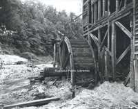
Close-up view of Poage's Mill waterwheel on Back Creek.

FE081 Carvins Cove.jpg
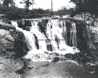
Waterfall at Carvins Cove.

FE082 Almshouse.jpg
The Almshouse or "poor house" was built in 1925. The building is now part of Virginia Western Community College.

FE083 Natural Bridge Hotel.jpg
The original Natural Bridge Hotel. The hotel burned in 1963 and was replaced by the current hotel in 1964.

FE084 Muse Family.jpg
Calvin and Harriet Muse stand with their sons, George and Willie, after the family is reunited in 1927. George and Willie's story is detailed in 'Truevine: Two Brothers, a Kidnapping, and a Mother's Quest' by Beth Macy.

FE085 Webster Brick.jpg
Webster Brick Company (now General Shale), located at 2351 Webster Road.

FE086 Old 97.jpg
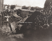
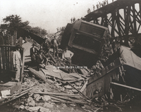
The wreck of the "Old 97" was an American rail disaster involving the Southern Railway mail train, officially known as the Fast Mail, while en route from Monroe, Virginia, to Spencer, North Carolina, on September 27, 1903. Due to excessive speed in…

FE088 Roanoke Machine Shop Band.jpg
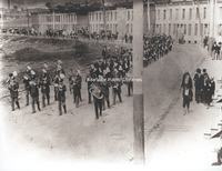
Led by the Roanoke Machine Works band, the funeral procession of William Nolty winds slowly past "Brick Row" on E. Campbell Avenue. "Brick Row" was built as a low-rent housing area for mostly less skilled workers at Roanoke Machine Works. The…

FE089 Old 97.jpg
The wreck of the "Old 97" was an American rail disaster involving the Southern Railway mail train, officially known as the Fast Mail, while en route from Monroe, Virginia, to Spencer, North Carolina, on September 27, 1903. Due to excessive speed in…

FE090 Red Men's Band.jpg
Hiawatha Tribe Number 66, Red Men's Band at Hotel Roanoke.

FE091 Roanoke Country Club.jpg
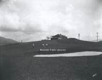
Golf Course at Roanoke Country Club.

FE092 Armistead Neal House.jpg
Armistead Neal tavern and boarding house was located on Shenandoah Avenue. For many years, it served the town of Big Lick as a hotel.

FE093 Mill Mountain.jpg
A view of Mill Mountain. Building in foreground was the Adams, Payne, Gleaves, Livery Stable No. 2. Abandoned by the time of this photograph, it is used to promote the purchase of war bonds.

FE094 Old 97.jpg
The wreck of the "Old 97" was an American rail disaster involving the Southern Railway mail train, officially known as the Fast Mail, while en route from Monroe, Virginia, to Spencer, North Carolina, on September 27, 1903. Due to excessive speed in…

FE098 Pythian Castle Hall.jpg
Groundbreaking for Pythian Castle Hall, Osceola Lodge No. 47 on Franklin Road. Shown are George Davis, Stuart A. Barbour, Frank N. Smith, and Charles D. Keffer.

FE103 Natural Tunnel.jpg
Natural Tunnel in Scott County. The massive naturally formed cave is so large, it is used as a railroad tunnel.

FE107 Roanoke Bankers.jpg
Group portrait of Roanoke bankers in front of the Terry Building.

FE109 2nd VA Company G.jpg
Spanish-American War United States Veterans, Company G, 2nd Virginia Volunteers, Dewey Mess. Pictured are : H.H. Zink, E.M. Carr, Pat Sullivan, A.T. Day, F.M. Moore, C.W. Rolen, J.T. Donnelly, G.D. Black, J.L. Bonavita, G.W. Misel, R.L. Tremain,…

FE111 Hancock-Clay.jpg
In the Coulter Building, the Hancock-Clay Company opened a department store in 1926. This interior view shows some of the dry goods and notions sold by Hancock-Clay. The firm became bankrupt in the early 1930s.

FE112 First Presbyterian.jpg
First Presbyterian Church, located at 2101 Jefferson Street SW.

FE116 Roanoke Country Club.jpg
Roanoke Country Club, located at 3360 Old Country Club Road NW, shortly after completion of the clubhouse.

FE117 Salvation Army Hotel.jpg
Salvation Army Hotel, formerly located at 201 2nd Street SW.

FE120 N&W General Offices.jpg
Norfolk & Western General Offices, located at 8 N. Jefferson Street, replaced the old General Offices after they were destroyed by fire in 1896. This building would be used in this capacity until 1932 when the new office building was completed.

FE121 Belmont Elementary.jpg
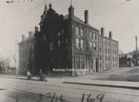
Belmont Elementary School was located on Dale Avenue in southeast Roanoke. The school was built in 1891 and remained in operation until 1974 when Fallon Park Elementary School was completed.

FE123 Ponce de Leon.jpg
The second Ponce de Leon Hotel located at 131 Campbell Avenue SW.

FE124 Commerce Street School.jpg
Commerce Street School, also called First Ward School, was located at the corner of Church Avenue and 2nd (Commerce) Street. Built in 1890, it was razed in 1929 to make room for the post office.

FE126 Harrison School.jpg
The Harrison School was completed in 1916. Two years later, the first high school classes for African American students began at Harrison School. Three students graduated in 1924, due largely to the persistence of Harrison's principal, Lucy…

FE128 Sherwood Forest.jpg
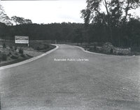
Entrance to Sherwood Forest subdivision, located at Yellow Mountain Road and Nottingham Road.

FE130 Morice Twine Mill.jpg
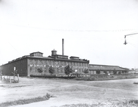
The Morice (formerly Roanoke) Twine Mill in Norwich. Built to house the Norwich Lock Company in 1891, the lock company was a short-lived enterprise. In 1901, the Roanoke Cotton Mill moved into the abandoned building.

FE131 Boggs & Havnaer.jpg
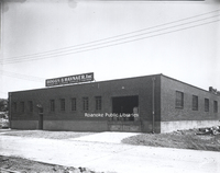
Boggs & Havnaer Laundry and Dry Cleaning supplies and equipment, formerly located at 912 3 1/2 Street SE.

FE136 Morningside Elementary.jpg
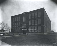
Morningside Elementary School, located at 1716 Wilson Street SE.

FE137 Stonewall Jackson Middle.jpg
Stonewall Jackson Middle School located at 1004 Montrose Avenue SE shortly after completion. The school's name was changed to John P. Fishwick Middle School in 2018.

FE138 Jamison School.jpg
Jamison Elementary School was located on the southwest corner of Jamison Avenue and 14th Street SE. The school was built in 1916 and razed in 1975.

FE139 Lucy Addison High.jpg
Lucy Addison High School opened in 1928. Located at 40 Douglass Avenue NW, the building now houses Roanoke City Public Schools Administrative Offices.

FE140 Stonewall Jackson Middle.jpg
Stonewall Jackson Middle School located at 1004 Montrose Avenue SE. The school's name was changed to John P. Fishwick Middle School in 2018.

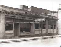
FE142 Roanoke Printing Company.jpg
Roanoke Printing Company occupies the Bolling Building, formerly located on the southwest corner of Church Avenue and 1st Street SW.

FE144 Highland Park Elementary.jpg
Built in 1920, Highland Park Elementary School is located at 1212 5th Street SW.

FE146 Roanoke Hospital.jpg
Roanoke Hospital was built in 1893 with the aid of Norfolk & Western and the Roanoke Gas and Water Company. Carilion Roanoke Memorial now occupies the site of the old hospital.

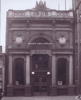
FE147 State & City Bank.jpg
Built in 1905, the building located at 116 Campbell Avenue SW was home to two banks in its early years, State & City Bank in this photograph and Day & Night Bank.

FE150 Jefferson High.jpg
Originally constructed in 1922, Jefferson High School was Roanoke's largest high school for half a century.

FE151 Wasena Elementary.jpg
Wasena Elementary School is located at 1125 Sherwood Avenue SW.

FE153 Ole Monterey Golf Course.jpg
Roanoke Country Club, located at 3360 Old Country Club Road NW.

FE156 Crystal Spring Laundry.jpg
Crystal Spring Laundry was located at 720 Franklin Road SW.

FE157 Ole Monterey Golf Course.jpg
Built in 1920, Ole Monterey Golf Course is the second oldest golf course in the City of Roanoke.

FE159 Mountain View.jpg
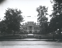
Mountain View, a 40 room elegant turn-of-the-century mansion, was built in 1907 by Junius B. Fishburn. Mr. Fishburn donated Mountain View to the City in 1955 with the stipulation that it be used solely and exclusively for public recreation purposes.…

FE162 N&W General Offices.jpg
Completed in 1883 by the Shenandoah Valley Railroad, the general office building housed the offices for Norfolk & Western after they were moved from Lynchburg. The building was located on the northwest corner of Jefferson Street and Shenandoah…

FE171 Roanoke Photo Finishing.jpg
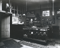
An interior view of Roanoke Photo Finishing Company with George Davis behind counter.

FE175 Roanoke High School.jpg
Roanoke High School was built in 1898 on the northeast corner of Church Avenue and 3rd Street SW. It became the school administration building in 1924 after Jefferson High School opened. It was razed in 1968 for construction of the Municipal…

FE178 Elmwood Park.jpg
A scene in Elmwood Park.

FE182 Jefferson Street.jpg
Looking south on Jefferson Street from the Colonial Bank building.

FE185 Campbell Avenue.jpg
Looking east from the 100 block of Campbell Avenue.

FE188 Burrell Memorial.jpg
Roanoke's first African American hospital, Burrell Memorial, was founded in 1915 in a small cottage on Henry Street. It soon outgrew the Henry Street location and moved into the former Alleghany Institute, a school for boys located at 611 McDowell…

FE189 Fenton China.jpg
Fenton China and House Furniture, formerly located at 306 S. Jefferson Street.

FE195 Campbell Avenue.jpg
Lyle's Drugstore occupied the right half of this building, located at 101 Campbell Avenue SW.

FE196 Roanoke Baseball.jpg
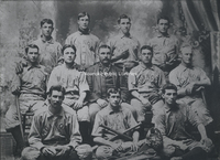
Roanoke Baseball Team. Front row, left to right: Dusty Coons, ? Wrigley, ? Lynch; middle row, L to R: unidentfied, unidentfied, Pop Tate (manager), G. McGann, ? Hill; back row, L to R: Ed McGinnis, unidentified, unidentified, and ? Williams.

FE198 Mountain Trust Bank.jpg
The temporary quarters of Mountain Trust Bank, formerly located at 34 W. Church Avenue.

FE199 Terra Alta.jpg
"Terra Alta" located at 1348 Prospect Road SE.

FE200 WDBJ Radio.jpg
Virginia's second commercial radio station, WDBJ-AM, had been broadcasting for twelve and a half years when it moved to its new quarters at 124 Kirk Avenue SW in January 1937.

FE201 State & City Building.jpg
State & City Building, located at 102 Campbell Avenue SW.

FE202 Blue Ridge Springs.jpg
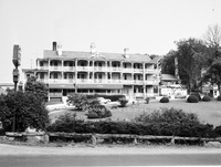
Blue Ridge Springs was one of a number of summer resorts in Southwestern Virginia. It boasted the healing powers of dyspepsia in its natural spring. Like many resorts of its kind, Blue Ridge Springs fell into disrepair during the Great Depression. …
FE203 Virginia College.jpg
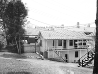
The Virginia College for Young Women was located in the South Roanoke neighborhood at the end of Rosalind Avenue. The college closed in 1933.

FE205 Police Switchboard.jpg
Switchboard at Police headquarters. Sargeant Dick Arnold uses the phone as motorcycle officer John Lemon looks on.

FE206 Mountain Lake.jpg
Canoers on Mountain Lake. The second Mountain Lake Lodge, built in 1875, can be seen in the distance. The current stone lodge replaced this structure in 1936.

FE208 Crockett Springs.jpg
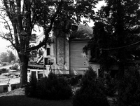
Crockett Springs Resort, near Shawsville, was one of a number of summer resorts in Southwestern Virginia that boasted the healing powers of its spring waters. The resort opened in 1889 and closed shortly before 1940. The hotel was razed in 1966.
FE211 Witten-Martin Furniture.jpg
Located at 213 1st Street SW, the Masonic temple was constructed in 1911. For many years, the first floor was occupied by various retail establishments, as evidenced in this photograph when Witten-Martin Furniture Company occupied the space.

FE214 Campbell Avenue.jpg
Looking west on Campbell Avenue.

FE222 Primitive Dentistry.jpg
Onlookers in Ballyhack watch as the seated gentleman in this photograph is having a tooth extracted by the lady in front of him, while the one behind him holds his head still.

FE224 Grandin Road.jpg
Looking south on Grandin Road from the 1700 block.

FE225a Westover Avenue.jpg
Looking east on the 2000 block of Westover Avenue SW. The neighborhood is still under development at the time of this photograph.

FE225b Maiden Lane.jpg
Looking east on the 2000 block of Maiden Lane SW. The neighborhood is still under development at the time this photograph was taken.

FE226 Maiden Lane.jpg
Looking west from the 1900 block of Maiden Lane. The neighborhood is still under development at the time of this photograph.

FE236 N&W Shops.jpg
Aerial view of Norfolk & Western east end shops.

FE239 Grandin Road.jpg
Looking northeast on Grandin Road at the intersection with Shirley Avenue.

FE241 Blue Ridge Springs.jpg
Blue Ridge Springs was one of a number of summer resorts in Southwestern Virginia. It boasted the healing powers of dyspepsia in its natural spring. Like many resorts of its kind, Blue Ridge Springs fell into disrepair during the Great Depression. …
FE250 Police Car.jpg
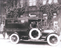
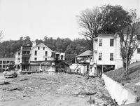
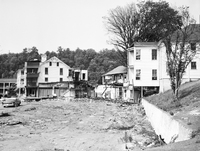
Parked in front of the city jail, is this blue and white, fifty horsepower Cadillac patrol wagon. It could carry as many as eight prisoners in its enclosed compartment, while the policeman had to ride exposed to the elements.
FE255 Jefferson Hospital.jpg
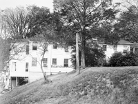
Jefferson Hospital, founded in 1907 by Dr. Hugh Trout, was the predecessor of Carilion Roanoke Community Hospital. Formerly located at 1313 Franklin Road SW, the hospital closed in 1967 and was later razed.

FE256 Stone Printing.jpg
Stone Printing Company began doing business at this location in 1891. The stone veneer was added to the building, located at 116 N. Jefferson Street, in 1907.

FE257 Lee Junior High.jpg
Lee Junior High School was built in 1912 at the intersection of Franklin Road and 2nd Street SW. It was razed in 1973 to clear the site for construction of the Richard H. Poff Federal Building.

FE258 Jefferson Street.jpg
Looking south on Jefferson Street from Salem Avenue.

FE260 Jefferson Street.jpg
Looking north on Jefferson Street from the 300 block.

FE261 Christ Episcopal.jpg
Christ Episcopal Church, located at 1101 Franklin Road SW.

FE263 Day and Night Bank.jpg
Built in 1905, the building located at 116 Campbell Avenue SW was home to two banks in its early years, Day & Night Bank in this photograph and State & City Bank.

FE265 Mill Mountain.jpg
A view of Mill Mountain showing a relatively undeveloped foreground.

FE266 Lorraine Apartments.jpg
Shown under construction are the Lorraine Apartments, located at 1221 S. Jefferson Street.

FE267 Williamson Building.jpg
Intersection showing the Williamson Building on the northwest corner of Church Avenue and Jefferson Street. At the time of this photo it was occupied by the Sportsman, Deb Fashions, Thom McCann Shoes. The building was razed in 1977.

FE268 Lorraine Apartments.jpg
Shown under construction are the Lorraine Apartments, located at 1221 S. Jefferson Street. This view shows the rear of the building from Maple Avenue SW.

FE269 Roanoke Knitting Mills.jpg
Roanoke Knitting Mills began operations in 1903 at 306 Elm Avenue SE. It closed by 1909.

FE270 Main Street.jpg
Aerial viewing showing Main Street in Salem near the intersection with Union Street and Academy Street.

FE271 Roanoke Public Warehouse.jpg
Roanoke Public Warehouse was located at 403 Salem Avenue.

FE272 Ponce de Leon Hotel.jpg
The original Ponce de Leon Hotel located at 131 Campbell Avenue SW. The elegant verandas are gone by the time this photograph was taken. In December 1930, the building was totally destroyed by fire, killing one resident and injuring others. It was…

FE273 Market Building.jpg
The Market Building appears largely unchanged today from when it was built in 1922.

FE274 Victory Stadium.jpg
Athletic field and grandstands at Victory Stadium. The stadium was built in 1942 and razed in 2006.

FE275 Victory Stadium.jpg
Athletic field and grandstands at Victory Stadium. The stadium was built in 1942 and razed in 2006.

FE276 Municipal Building.jpg
The Municipal Building was built in 1915.

FE278 Prospect Road.jpg
Mill Mountain’s Prospect Road, commonly called the Loop Road or Old Toll Road, still has the same basic design when it originated as a graded carriage road in 1891. Today, the road is part of the Roanoke Valley’s greenway system within Mill Mountain…

FE279 McBain Building.jpg
The McBain building, located at 34 Campbell Avenue.

FE280 Hammond Printing.jpg
Hammond's Printing and Litho Works, formerly located on the southeast corner of Jefferson Street and Luck Avenue,

FE281 Phelps & Armistead.jpg
Phelps & Armistead Furniture, formerly located at 312 2nd Street SW. The building would later be occupied by Grand Piano.

FE283 Post Office.jpg
Roanoke's second federally funded post office was constructed on the same site as the first, the corner of Church Avenue and 1st Street. It was built in 1914 and replaced in 1933.

FE284 Roanoke Lodge #197.jpg
Roanoke Lodge #197 of the Benevolent and Protective Order of Elks. The lodge stood on the southeast corner of Jefferson Street and Franklin Road

FE285 Colonial Bank Building.jpg
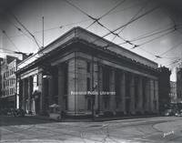
Colonial National Bank building, located at 202 S. Jefferson Street.

FE286 Roanoke Auditorium.jpg
Roanoke Auditorium was located along Wells Avenue NE, between Williamson Road and 2nd Street. Built in 1916, it was purchased in 1947 by the American Legion and thence called the American Legion Auditorium. It served the city well as an all-purpose…

FE287 Roanoke High School.jpg
Roanoke High School was built in 1898 on the northeast corner of Church Avenue and 3rd Street SW. It became the school administration building in 1924 after Jefferson High School opened. It was razed in 1968 for construction of the Municipal…

FE288 McBain Building.jpg
The McBain building, located at 34 Campbell Avenue.

FE289 Medical Arts Building.jpg
Located at 30 Franklin Road, the Professional (or Medical) Arts Building was built in 1929.

FE290 City Hotel.jpg
City Hotel was built in 1886 on the southeast corner of Jefferson Street and Salem Avenue.

FE291 School Administration.jpg
Roanoke High School was built in 1898 on the northeast corner of Church Avenue and 3rd Street SW. It became the school administration building in 1924 after Jefferson High School opened. It was razed in 1968 for construction of the Municipal…

FE292 Crystal Spring.jpg
A view of Crystal Spring Park, pump house, and reservoir. Crystal Spring was one of the city's earliest landscaped parks. It was designed and managed by Roanoke Gas and Water Works.

FE293 Jefferson Apartments.jpg
The Jefferson Apartments, formerly located at 820 S. Jefferson Street. This view looks west on Mountain Avenue.

FE294 Shenandoah Building.jpg
The Shenandoah Building is located at 305 1st Street.

FE295 People's Bank.jpg
People's Bank building located at 201 S. Pollard Street in Vinton.

FE296 McGuire Building.jpg
The McGuire Building and Market Square.

FE297 Jackson Ferry Shot Tower.jpg
Jackson Ferry Shot Tower in Wythe County. The tower is 75 feet tall and was used for manufacturing lead shot. Construction began shortly after the American Revolution and was completed in 1802. The shot tower is now Shot Tower State Park.

FE298 Coulter Building.jpg
Built in 1926, the Coulter Building is located at 601 S. Jefferson Street.

FE299 Buena Vista.jpg
Buena Vista was contructed by Colonel George P. Tayloe around 1840.

FE300 Roanoke Auditorium.jpg
Roanoke Auditorium was located along Wells Avenue NE, between Williamson Road and 2nd Street. Built in 1916, it was purchased in 1947 by the American Legion and thence called the American Legion Auditorium. It served the city well as an all-purpose…

FE301 Market Square.jpg
In the days before trucks were ubiquitous, farmers brought their goods to the City Market in buckboards, carts, and Conestoga wagons.

FE302 Melrose Baseball.jpg
Melrose Athletic Club baseball team and mascot.

FE303 Prospect Road.jpg
Mill Mountain’s Prospect Road, commonly called the Loop Road or Old Toll Road, still has the same basic design when it originated as a graded carriage road in 1891. Today, the road is part of the Roanoke Valley’s greenway system within Mill Mountain…

FE304 Observation Tower.jpg
The first observation tower on Mill Mountain was constructed in 1910 and destroyed by a violent wind storm in 1914. It was replaced shortly thereafter by another observation tower, which burned in 1936.

FE305 Roanoke Country Club.jpg
Greens and fairways at Roanoke Country Club. The clubhouse is just visible in the background.

Floyd Press Obituary Index.pdf
This document is an alphabetical listing of nearly 10,000 obituaries printed in the Floyd Press from 1944-1990. The Floyd Press is available on microfilm in the Virginia Room for these years.

Funeral Program Index.pdf
The Funeral Program and Obituary Index includes funeral programs, in memoriam articles and obituaries that are housed at the Gainsboro Branch of Roanoke Public Libraries.

Revised Vertical File Index .pdf
The Vertical Files and Surname Files Index is an alphabetical list of over 250 topical files. Vertical files may include pamphlets, news clippings and other materials that do not merit a call number, but are arranged for ready reference on a given…
RS001.jpg
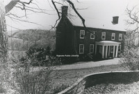
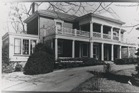
“Old First Baptist Church & St. Andrews Catholic Church, November 3,1990-Roanoke Va.” (Reprint, library owns digital copy only, not original.)

RS002.jpg
“Ricardo C. Stovall & Bike on Patton Ave. N.E (Claytor House in Background) about 1959” (Reprint, library owns digital copy only, not original.)

GB001 Dr Paxton.jpg
Dr. Lawrence E. Paxton operated a dental practice on Wells Avenue.

GB003 LAHS Majorettes.jpg
Lucy Addison High School Majorettes in front of the Gainsboro Library.

GB004 LAHS Girls Basketball Team.jpg
Lucy Addison High School Girls' basketball team.

GB005 Aladdin Temple #34.jpg
Aladdin Temple #34 on parade, Patton Avenue in front of St. Andrew’s Catholic Church.. “Miss Bertha White, Ill. Commandress, Roanoke, VA.”

GB006 Burrell Memorial Hospital.jpg
Unidentified function on the grounds of Burrell Memorial Hospital.

GB009 Nursing Staff at Burrell Memorial Hospital.jpg
The nursing staff of Burrell Memorial Hospital at an unidentified function on the hospital's grounds.

GB010 LAHS Football Game at Victory Stadium.jpg
Lucy Addison High School football game at Victory Stadium.

GB100.jpg
Group of women in formal attire in front of a stage with instruments.

Tags:

GB101.jpg
Unidentified group photograph at night.

Tags:

GB102.jpg
Unidentified group photograph of women.

Tags:

GB103.jpg
Unidentified group photograph of men at a table.

GB104 Economy Shoe Repair.jpg
Economy Shoe Repair on Henry Street. Shop owner Earnest O. Greene.

GB104.1 Economy Shoe Repair.jpg
Economy Shoe Repair on Henry Street.

GB105.jpg
Gainsboro Library, exterior, with a children’s class.

GB106.jpg
Children dressed in costume in front of the Gainsboro Library.

GB107.jpg
Group of children in front of the Gainsboro Library.

GB108.jpg
Gainsboro Library, interior, with a group of library patrons. YMCA location.

GB109.jpg
Gainsboro Library, interior. Virginia Y. Lee, center.

GB110.jpg
Gainsboro Library, interior, with children.

GB110.1.jpg
Gainsboro Library, interior, with children.

GB110.2.jpg
Gainsboro Library, interior, with children.

GB111.jpg
Gainsboro Library, interior, child sitting at a table.

GB112.jpg
Gainsboro Library, interior.

GB112.1.jpg
Gainsboro Library, interior.

GB113.jpg
Virginia Y. Lee at the Gainsboro Library.

GB114.jpg
Library display at the Gainsboro Library.

GB115.jpg
Gainsboro Library display with Virginia Y. Lee.

GB116.jpg
Young man reaching for a book at the Gainsboro Library

GB117.jpg
Children reading books at the Gainsboro Library.

GB118.jpg
Children working on a project at the Gainsboro Library.

GB119.jpg
Mother and infant at the Gainsboro Library.

GB012 Dr. J. H Roberts.jpg
Dr. James H. Roberts was a co-founder of Burrell Memorial Hospital, Magic City Medical Society, and the William A. Hunton YMCA.

GB120.jpg
Children posing in front of a Book Week display at the Gainsboro Library.

GB120.1.jpg
Children posing in front of a Book Week display at the Gainsboro Library.

GB121.jpg
Geneva Ford, library staff member, at the Gainsboro Library.

GB122.jpg
Group of children sitting in a room.

Tags:

GB123.jpg
Group of children participating in a pageant or play.

Tags:

Output Formats

atom, dc-rdf, dcmes-xml, json, omeka-xml, rss2