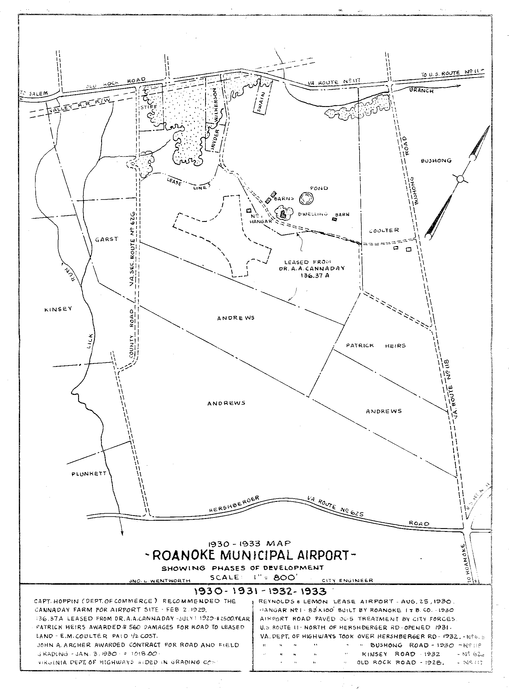
RAC58 1930-33 Map
FILES
Dublin Core
Title
RAC58 1930-33 Map
Description
This blueprint of the Roanoke Municipal Airport illustrates its development between 1930 and 1933. According to data on the blueprint, the Cannaday farm was recommended as the site for a municipal airport by the Department of Commerce in February 1929. On July 1, 1929, the City of Roanoke leased 136 acres from Dr. A.A. Cannaday.
Date
1933
Contributor
City of Roanoke
Identifier
RAC58
Still Image Item Type Metadata
Original Format
Digital tiff
Collection
Citation
“RAC58 1930-33 Map,” Virginia Room Digital Collection, accessed April 20, 2025, http://www.virginiaroom.org/digital/document/RAC58.


